Microsoft digital twins export DTDL in beta

We have created an export of Smart Data Models in DTDL format. You’ll see them in the root directory named schemaDTDL.json.

A bit more than 500 models have got it because we are in the process of a final complete mapping between the possibilities of JSON schema and DTDL.

This is the first version for testing purposes and they are not meant to be ready for production. Anyhow, we welcome any feedback on them.

See this example schemaDTDL.json, and a tool for finding all of them is available here. (Same tool for any other search).


New method for drafting the json schema for a new data model

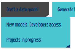
A new tool (capable of the creation of more complex data models) is available at the menu “Draft a data model”.
It is an external tool that simplifies the json schema needs.
Hope it speeds up the development of new data models and simplifies it for newcomers to this syntaxis.
Anyhow this is the best guide (simple and straight to the point we know)
It is also available at the learning zone in the upper menu.

The JSON schema is our single source of truth compiling into a single document the technical description with the definitions of every element in the data model.

OASC Joins the Smart Data models initiative

Open and Agile Smart Cities (OASC) has joined the Smart Data Models initiative. Today, 8th of June, it is announced officially their commitment with the principles of the initiative and as a member of the steering committee of the initiative together with TMForum, IUDX and FIWARE Foundation to provide open and free data models for their use in the development of smart applications.

OASC organization accounts with more than 150 cities in Europe, North and south America, Japan and Australia. They will join those cities grouped by other of the partners of the initiative IUDX, public entity of the Indian government for the data interchange between Smart cities in India.

Thus OASC will conscientiously support the adoption and promotion of Smart Data Models and will promote to its membership Smart Data Models in the context of OASC MIMS. FIWARE agrees to promote OASC as the global community of practice for cities and by cities concerning the digital transformation of cities, towns, and rural areas, in particular in but not limited to those regions where OASC does not yet have a presence.

This allows to align common efforts to support the models available in the initiative and to dissemination them worldwide.

Extended statistics of the site

Now there is a new page statistics with the main statistics regarding the content of the site.

It can also be found from the More stats link in the widget on the upper right corner of the front page.

Geojson features format examples available at examples directory

Those data models containing examples with a geoproperty, now there also include another file named: example-geojsonfeature.json with this format.

So not all the data models include this example, which is generated automatically (so there is not a need to be contributed).

See an example:


Geoproperties documented

Geoproperties were formerly not documented because it was not possible to include the description into the definition of the data model.

Previously, the definition of Geojson property was retrieved from the original source, which prevents the documentation to be added. No its has been cloned into the common-schema.json, and the description has been added. As a consequence, they appear in the specification of all data models (all of them have been updated) tonight.

Additionally, the schema checker (The test which assesses if a JSON schema is properly documented) no longer accepts any undocumented property (Example). So if you want a data model to be accepted then you need to get a 0.

The contribution manual has been adapted accordingly.

Smart Data Models at FIWARE Smart Fest #FIWARESmartFest. Questions open

The #FIWARESmartFest. From 8-10 June, is a three days online event with >100 speakers from around the globe, and 35 hours “live on air” sessions of exciting deep-dives showcasing the power of #opensource, outstanding use cases, trending topics in tech, the FIWARE Accelerator DAY, networking opportunities on AirMeet, and much more.

On June 9th 18:00 CEST we will hold the Smart Data Models session with these speakers (alpha order):

  • Alberto Abella (Data modeling Expert, FIWARE Foundation)
  • Gert De Tant. Chief Technical Architect. OASC
  • Iván Dvojak.  (Marketing Director, Tourism Posadas, Province of de Misiones, Argentina)
  • Pierre Gauthier. (Chief API Architect at TMForum)
  • Antonello Monti. (Director ACS / Chair Automation of Complex Power Systems at RWTH University)
  • Abhay Sharma. (VP Engineering, IUDX Program Unit, SID, IISc)

Have a look and don’t forget to grab yourself a free ticket. https://bit.ly/3bcRn0E
#opensource #opendata #datamodels #AI #blogchain #digitaltwins #smartcities #smartindustry #smartenergy #smartagrifoodindustry #smartwatermanagement #gaiax #smartdata #datasovereignty #dataspaces

There is a panel during the session and we expect that one or two questions could come from the attendants, or you can send it now at info@smartdatamodels.org

Coming soon the detailed contents of the session.


10 Risk Management Data models published

The dataModel.RiskManagement subject has available 10 data models for risk management.

  • Asset. An item of value to stakeholders. An asset may be tangible (e.g., a physical item such as hardware, firmware, computing platform, network device, or another technology component) or intangible (e.g., humans, data, information, software, capability, function, service, trademark, copyright, patent, intellectual property, image, or reputation). The value of an asset is determined by stakeholders in consideration of loss concerns across the entire system life cycle. Such concerns include but are not limited to business or mission concerns.
  • CyberAnalysis. The entity that represents analysis performed by digital tools to detect for example, network traffic anomalies
  • Exposure. This entity contains a harmonized description of a generic Exposure Entity made for the Risk Assessment domain.
  • GISData. This entity contains a harmonized description of generic GISData made for the Risk Assessment domain.
  • Hazard. This entity contains a harmonized description of a generic Hazard entity made for the Risk Assessment domain.
  • Measure. Specific measure translated into actions to be performed into the different systems
  • Mitigation. The mitigation of consequences reduces the risk after an event has occurred. Therefore, this risk reduction measure is not suitable for the reduction of the likelihood of events but for the reduction of the negative consequences. Examples for consequence mitigation measures could be e.g. the construction of connection pipes to the neighbor water supplier(s) to get water from them in case of a breakdown of the own water supply, the construction of wells for an emergency supply or signing of contracts with organizations providing small mobile emergency water treatment plants.
  • NetworkServiceAlert.
  • Risk. Effect of uncertainty on objectives. An effect is a deviation from the expected—positive and/or negative. Objectives can have different aspects (such as financial, health and safety, and environmental goals) and can apply at different levels (such as strategic, organization-wide, project, product and process). Risk is often characterized by reference to potential events and consequences, or a combination of these. Risk is often expressed in terms of a combination of the consequences of an event (including changes in circumstances) and the associated likelihood of occurrence. Uncertainty is the state, even partial, of deficiency of information related to, understanding or knowledge of, an event, its consequence, or likelihood.
  • Vulnerability. This entity contains a harmonized description of a generic Vulnerability Entity made for the Risk Assessment domain.

Thanks to the Contributors

New data models OpenChannel and CrossSection (update 23-9-21)

These data models,  OpenChannel and CrossSection belong to the new subject OpenChannelManagement for the management of the provisioning of water through open channels.

  • CrossSection. This entity contains a harmonized description of a generic Cross-Section made for Raw-Water (Open Channels) System Management domain. A CrossSection defines any point of the system where raw-water properties are monitored by a device and/or computed via simulation.
  • OpenChannel. This entity contains a harmonized description of a generic Channel made for Raw-Water (Open Channels) System Management domain.

Other data models in the incubated repository for this subject


New option in the menu for geojson features export

In the main menu option

Generate NGSI examples -> Geojson features format

This option allows you to generate random payloads compliant with a data model in Geojson features format.